Physical Address
304 North Cardinal St.
Dorchester Center, MA 02124
Physical Address
304 North Cardinal St.
Dorchester Center, MA 02124

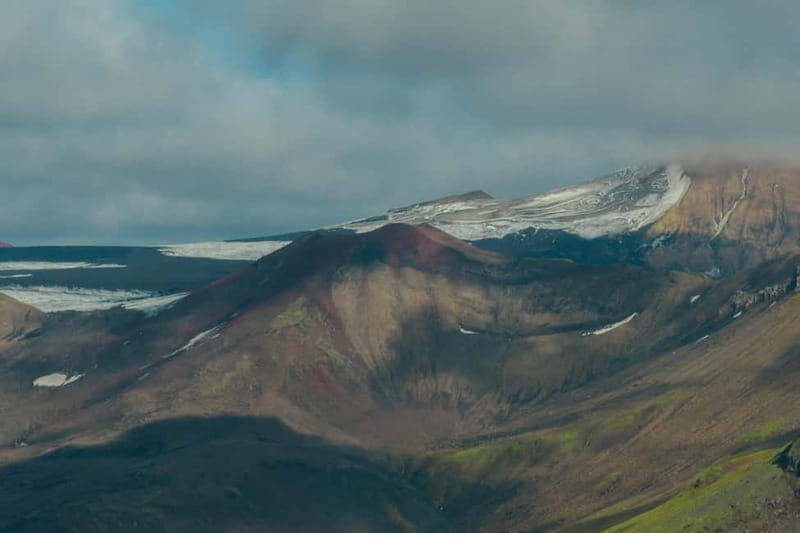
Explore Iceland’s Tindfjallajökull glacier with a 8-hour mapping expedition, contribute as a Citizen Scientist, and witness climate change firsthand in stunning highland terrain.
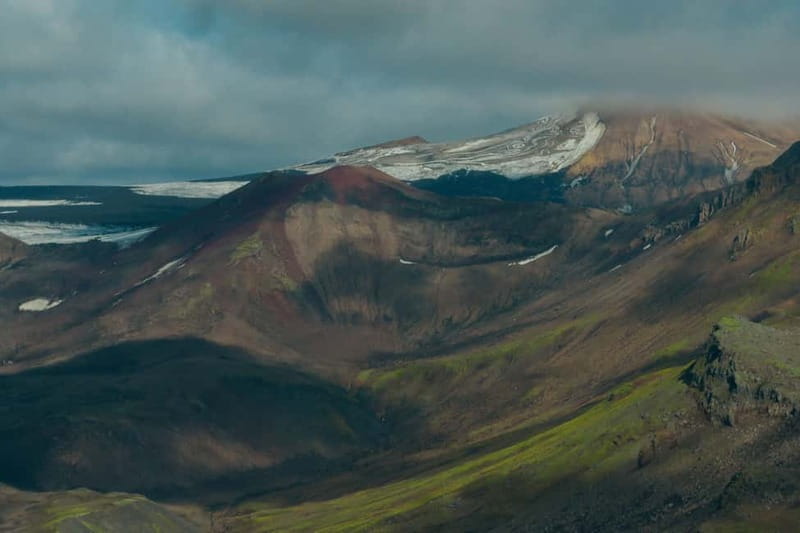
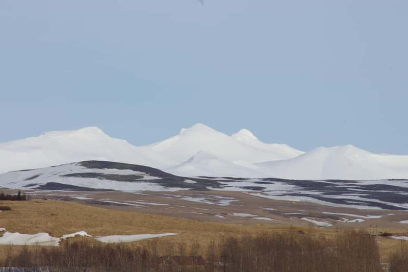
The Iceland: Tindfjallajökull Glacier Mapping Expedition offers a rare chance to see one of Iceland’s lesser-known glaciers up close while actively participating in climate research. Priced at a full-day 8-hour experience, this tour departs from the N1 Gas Station in the Southern Region and takes you deep into the highland terrain far from crowds. The journey combines a thrilling 4×4 ride with hands-on glacier mapping, making it ideal for those interested in environmental issues and outdoor adventure alike.
What makes this expedition stand out? Not only do participants witness the dramatic effects of rising temperatures on the retreating Tindfjallajökull glacier, but they also receive a Citizen Scientist certificate from Katla Geopark. This tour is suitable for physically fit travelers who enjoy moderate hikes and are eager to learn about climate change through direct observation. Keep in mind, the experience is not suitable for children under 10, people with back problems, or wheelchair users.
You can check availability for your dates here: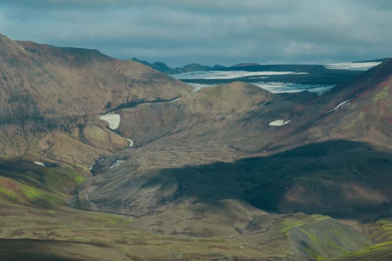
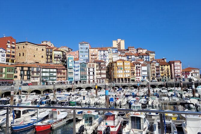
Planning more time in Southern Region Iceland? We've covered other experiences worth considering.
The expedition begins at the N1 Gas Station in Hvolsvöllur, a common meeting point for tours in the Icelandic South. Participants will be picked up by a professional licensed driver-guide who leads the group through the highland landscapes. The 4×4 vehicle provides a safe and comfortable ride up to the glacier outlet, setting the stage for the hiking portion of the tour.
The tour’s plan is flexible, with possible adjustments based on weather and safety conditions — a useful feature in Iceland’s unpredictable climate. The journey ends back at the original meeting point, making logistics straightforward for travelers. Note that transportation to the meeting point is not included, so travelers should arrange their own transfer.
The adventure starts with a thrilling 4×4 ride across Iceland’s rugged highland terrain. This part of the journey is scenic, with panoramic views that showcase the vastness of Iceland’s wilderness. The vehicle ascends toward the glacier outlet, giving travelers a taste of the remote beauty far from tourist-filled spots.
This drive is essential for reaching the glacier safely, especially considering the rough terrain and environmental preservation efforts. The landscape’s untouched quality offers a peaceful escape and a chance to appreciate the raw power of nature. The ride lasts around a few hours, depending on weather and group pace, setting the tone for the hikes ahead.
After the 4×4 journey, the group embarks on a moderate hike through rugged terrain to reach the edge of Tindfjallajökull. The walk provides opportunities to observe scenic volcanic formations and glacial features, all while practicing safety with all necessary scientific and glacier safety equipment provided.
The hike is designed for participants in good physical condition and has been described as moderate difficulty. Proper footwear, warm clothing, and rain gear are recommended to handle Iceland’s changing weather. The terrain is rough but manageable, and guides are experienced in ensuring safety and providing personalized instruction during the mapping process.
More Great Tours NearbyA core aspect of this tour is hands-on glacier mapping, where participants help document changes in the glacier’s surface and environment. This activity not only enhances understanding of climate change effects but also contributes valuable data to ongoing research.
Participants will learn about glacial features and how to record observations accurately. The results of the mapping are emailed afterward, providing an added sense of contribution and engagement. The mapping process focuses on last-year, last-month, last-week, and last-day changes, painting a detailed picture of the glacier’s retreat.
Midway through the expedition, a packed lunch is served in the shadow of Tindfjallajökull’s peaks. This meal offers a perfect chance to rest and reflect while surrounded by serene, untouched landscapes. The setting allows for peaceful appreciation of the raw beauty of Iceland’s highlands and the ongoing effects of climate change visible around the glacier.
Participants are encouraged to bring their own snacks, water, and camera to capture the scenery and document their experience. The lunch break adds a relaxed element to the otherwise physically active day.
All participants are awarded a Citizen Scientist certificate from Katla Geopark recognizing their contribution to glacier research. Plus, the mapped results are emailed after the expedition, giving participants insight into the specific changes they recorded.
Their name is published in a Geopark report, offering further acknowledgment of their role in environmental monitoring. The tour also provides ongoing updates via email, keeping everyone informed about the glacier’s evolution and related scientific findings.
The tour includes all scientific and safety equipment, but participants need to bring their own comfortable shoes, warm clothing, rain gear, and hiking shoes. A camera is highly recommended for capturing the landscape, along with snacks and water for sustenance during the day.
Since the experience is moderate in difficulty, travelers should be in good physical condition. Participants are advised against smoking during the tour and should prepare for variable weather conditions. The packed lunch is included, but supplies should be carried along, and personal items kept secure during hikes.
Weather conditions in Iceland can change rapidly, so flexibility in planning is vital. The tour operator, Gravel Travel, reserves the right to adjust the schedule or switch focus (e.g., to dead ice mapping or different glacier edges) based on safety and weather.
The group is limited in size, ensuring a more personalized experience and proper guidance. The tour is not suitable for children under 10 or travelers with certain health conditions. Insurance is not included, so travelers should consider their own coverage for outdoor activities.
Unlike most glacier tours that focus on hiking or sightseeing, this expedition emphasizes scientific contribution and climate change awareness. The small, private group setting offers a more focused and educational experience.
While the 8-hour duration might seem long, the combination of adventure, learning, and scenic views makes it worthwhile for nature enthusiasts and environmental advocates. It’s a distinctive tour for those wanting to see Iceland’s glaciers in transition and feel part of meaningful research.
The Iceland: Tindfjallajökull Glacier Mapping Expedition provides a combination of outdoor adventure, scientific engagement, and spectacular scenery. The tour’s focus on climate change documentation makes it a thought-provoking choice for travelers eager to understand and witness the effects of global warming firsthand.
While it involves moderate physical activity and outdoor conditions, the guided expertise and personalized mapping activity ensure a safe and educational experience. The packed lunch, certification, and ongoing data updates add meaningful value to this tour.
This experience suits travelers in good physical shape who appreciate nature, science, and adventure, and want to contribute to climate research while exploring Iceland’s wild landscapes.
Is this tour suitable for children?
No, it is not recommended for children under 10 years due to the physical demands and terrain.
What should I bring?
Bring comfortable shoes, warm clothing, rain gear, camera, snacks, and water for the day.
How long does the tour last?
The expedition lasts up to 8 hours, with start times depending on availability.
What is included in the price?
The tour includes a professional guide, 4×4 ride, scientific equipment, lunch, a Citizen Scientist certificate, and email results.
Is transportation to the meeting point provided?
No, participants need to arrange their own transportation to the N1 Gas Station in Hvolsvöllur.
Can I cancel the tour?
Yes, free cancellation is available up to 24 hours in advance for a full refund.