Physical Address
304 North Cardinal St.
Dorchester Center, MA 02124
Physical Address
304 North Cardinal St.
Dorchester Center, MA 02124

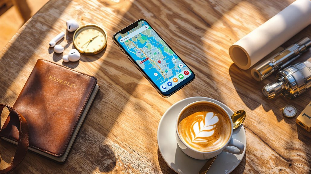
From must-have navigation tools to safety trackers, these essential travel apps will transform your next adventure into a seamless journey.
Essential travel apps transform your smartphone into a powerful travel companion. Google Maps leads with offline navigation and eco-friendly routes, while TripIt streamlines your itineraries from confirmation emails. You'll need Google Translate for language barriers, XE Currency for money conversions, and Airbnb for unique stays. Safety apps like Life360 and Sitata monitor risks, while Culture Trip and Polar Steps help you discover and document adventures. Let's explore these game-changing tools that'll revolutionize your next journey.
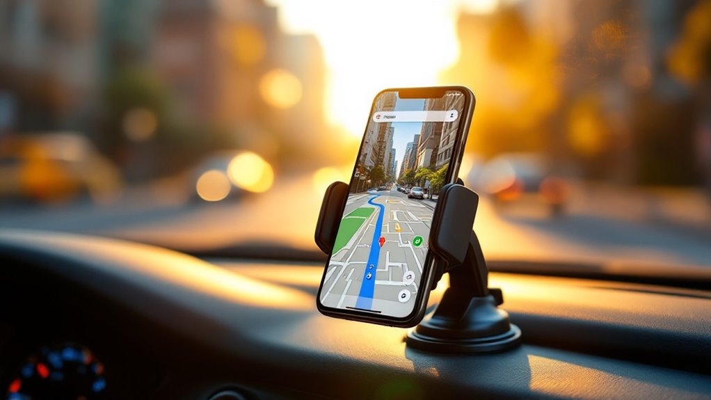
Navigation apps come and go, but Google Maps remains the undisputed champion of digital wayfinding, offering travelers an indispensable toolkit for exploring both familiar streets and uncharted territories.
You'll never worry about losing your way, even without data, thanks to downloadable offline maps that keep you on track using just your device's GPS.
The app's multi-stop routing lets you optimize your journey with unlimited destinations, while the Live View feature transforms your camera into a digital guide, overlaying directions and identifying landmarks in real-time. Eco-friendly routes marked with a leaf icon help reduce your carbon footprint while driving.
You can share your location with trusted contacts for safety, and discover local gems through detailed business profiles and immersive 3D previews.
Whether you're navigating a new city's subway system or finding the perfect coffee shop, Google Maps has you covered.
TripIt takes the hassle out of travel planning by automatically syncing your confirmation emails into one seamless itinerary, complete with flight details, hotel bookings, and restaurant reservations.
You'll stay informed with real-time updates about flight changes and gate switches, ensuring you're never caught off guard during your journey.
When you're on the go, the app's offline access feature lets you view your entire trip schedule without an internet connection, making it a reliable travel companion even in remote locations. For those seeking enhanced features, the Pro version subscription unlocks premium perks like seat tracker upgrades and lounge access information.
Nearly every traveler has experienced the frustration of juggling multiple travel documents across various emails and apps.
With TripIt, you'll never have to manually organize your travel documents again. Simply forward your confirmation emails to [email protected], and the app automatically creates a thorough itinerary by extracting key details from your flights, hotels, and activities.
You can securely store all your essential documents – from passports to boarding passes – in one centralized location, with PIN protection and encryption keeping your sensitive information safe. Pro subscribers receive helpful passport renewal reminders to ensure their travel documents stay current.
While the free version limits you to three documents per trip, there's a clever workaround: split your journey into multiple entries.
For seamless planning, TripIt syncs with your favorite calendar apps and even integrates with business platforms like Concur Travel.
When was the last time you sprinted across an airport terminal only to find your gate had changed? With TripIt's real-time flight updates, you'll never be caught off guard again. The app keeps you informed of every vital flight detail through instant push notifications.
You'll receive airline-independent updates through TripIt's proprietary tracking system, which monitors your inbound aircraft and potential delays. For even more accurate tracking, you can integrate with Flighty's data system to enhance your flight monitoring capabilities.
Whether you're racing to make a connection or planning your airport pickup, you'll have all the essential flight information right at your fingertips, making travel day surprises a thing of the past.
Three essential features make TripIt's offline access a lifesaver for frequent travelers: automatic downloads, extensive storage, and seamless synchronization. You'll have all your travel details at your fingertips, even when you're soaring at 35,000 feet with airplane mode on.
While you're connected to the internet, TripIt automatically downloads your complete itinerary, including flight details, hotel bookings, and car rentals. You can also store important documents like boarding passes and passport QR codes for quick access. This no manual download is required, making it effortless to prepare for offline travel.
The app's clean, minimalist interface makes finding your travel information a breeze, and the dark mode option comes in handy during those late-night flights. Once you're back online, any changes you've made to your plans will sync across all your devices, keeping everything up to date.
Since communication barriers can make or break your travel experience, Google Translate stands as an indispensable tool for globetrotters, supporting over 133 languages through text, voice, and image translations.
You'll find essential features that transform how you navigate foreign destinations, from scanning menus to facilitating real-time conversations with locals. The app's document upload feature allows you to translate important paperwork while traveling abroad.
While offline, you can still access basic translation features by downloading language packs beforehand.
Just remember to grab these essential packages over Wi-Fi, as they can range from 50-250MB in size.
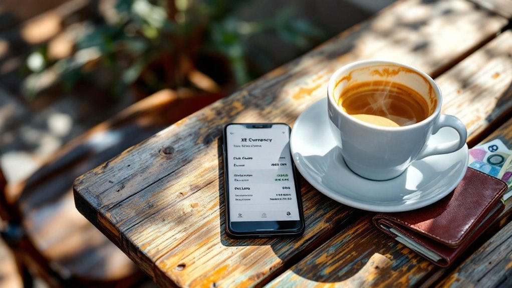
Managing foreign currencies can be one of the most challenging aspects of international travel, but XE Currency transforms this complex task into a seamless experience.
You'll get real-time updates for over 220 currencies, including cryptocurrencies, and the app's offline storage means you won't be stuck when your internet connection isn't perfect.
What sets XE Currency apart is its extensive features. You can track up to 20 currencies simultaneously, set customized rate alerts, and access historical data dating back to 1998. The app's clean interface design makes it exceptionally user-friendly for travelers of all experience levels.
Whether you're sending money to family abroad or calculating prices while shopping in Tokyo, the built-in calculator makes conversions a breeze.
With support in 10+ languages and coverage across all time zones, you'll never have to worry about getting accurate rates, no matter where your adventures take you.
You'll find over 7 million homes at your fingertips with Airbnb's user-friendly app, which lets you browse everything from cozy apartments to luxurious villas in more than 100,000 cities worldwide.
The app's smart search features help you narrow down options by price range, dates, and specific amenities, making it easy to find the perfect match for your budget and preferences. Approximately six guests every second check into an Airbnb property through the platform.
With an average booking value of $168 and instant access to detailed listings, reviews, and real-time host messaging, you're well-equipped to secure accommodations that feel like a home away from home.
When searching for a place to stay in any of 100,000+ cities worldwide, Airbnb's mobile app puts millions of unique accommodations right at your fingertips.
With 75% of all bookings happening through the app, you'll join millions of savvy travelers who've discovered the convenience of instant local home access.
Whether you're a business traveler or seeking an experiential getaway, you'll find the process remarkably smooth with transparent pricing and multi-step booking confirmation.
Plus, with an average stay of 4.3 nights, you'll have plenty of time to live like a local. The platform's success story began in 2007 when two entrepreneurs turned their living room into lodging, revolutionizing the way people think about travel accommodations.
Smart pricing tools have revolutionized how travelers find their ideal accommodations on Airbnb, with dynamic rates shifting based on factors like seasonal demand and local events.
You'll find the best deals by booking about four weeks ahead, as last-minute reservations typically cost 13% more than this sweet spot.
To maximize your savings, consider midweek stays, which can be up to 18% cheaper than weekends.
If you're planning an extended trip, you'll appreciate the 10-20% discounts often available for stays longer than four weeks.
While browsing, don't forget to toggle the "show total price" feature to see the complete cost, including cleaning fees and taxes.
For group travelers, you'll typically save 33% compared to hotels, though couples might find traditional hotels more economical.
Budget-conscious travelers should note that under $100 per night represents the price point for over 80% of Airbnb Rooms globally.
Through its innovative multimodal approach, Citymapper has revolutionized urban transit navigation by seamlessly integrating various transportation options into a single, user-friendly platform.
Citymapper transforms how we navigate cities by unifying diverse transit options into one intuitive, accessible solution.
You'll find extensive coverage in over 100 cities worldwide, with features that'll transform your urban travel experience.
Whether you're commuting or exploring a new city, Citymapper's got your back with offline trip saving and personalized alerts. The new mixed routes system combines public transport with bikes and e-scooters for maximum flexibility.
The app's integration with bike-sharing, e-scooters, and public transit means you'll always have the fastest, most cost-effective route at your fingertips.
When you're hunting for the best flight deals, Skyscanner's powerful search engine lets you compare options across multiple airlines and travel sites in seconds.
You'll love how easy it's to set up custom price alerts that notify you when fares drop on your favorite routes, taking the stress out of deciding when to book.
The app's streamlined booking process means you can secure your tickets directly through trusted partners, making your travel planning smoother than a first-class landing. The innovative Explore Everywhere feature helps you discover budget-friendly destinations when your travel plans are flexible.
As flight prices fluctuate dramatically throughout the year, Skyscanner's extensive search tools help you navigate the complexities of airfare pricing with remarkable precision.
You'll discover a wealth of features that make finding the perfect flight both exciting and cost-effective. The platform serves over 100 million users monthly, demonstrating its trusted status among savvy travelers.
The multi-city planning tool lets you craft complex itineraries with up to six flight legs, while the price forecasting algorithm helps you decide the perfect time to book.
Skyscanner's price alert system transforms the way you'll track flight deals, putting automated fare monitoring at your fingertips. After creating your free account, you can set up multiple alerts for specific routes and dates, receiving timely notifications when prices drop or rise.
To maximize your chances of scoring the best deals, try setting alerts for nearby airports and flexible date ranges. Simply click the bell icon in the app to begin tracking your desired flights. You'll get daily updates for trips within 100 days of departure and weekly notifications for those further out.
The desktop version lets you manage all your alerts in one place, while the mobile app sends real-time push notifications for sudden price changes. Pro tip: start tracking fares 3-6 months before your travel dates, and don't forget to disable alerts once you've booked to keep your notifications relevant.
Ready to streamline your travel booking experience? Skyscanner's direct booking functionality lets you secure flights without leaving the app when booking with partners like Singapore Airlines, Scoot, and Trip.com.
You'll enjoy a hassle-free process with pre-filled passenger details and access to seat selection and meal options right at your fingertips. The blue-colored direct booking button makes it easy to identify trusted booking partners.
The app's interactive map and "Everywhere" search tool help you discover the best deals while maintaining full control of your booking experience.
For non-partner airlines, you'll still need to complete your reservation on external sites, but the process remains straightforward and user-friendly.
When group travel expenses become a tangled mess of IOUs, Splitwise steps in as your digital peacekeeper for shared costs.
You'll appreciate its multi-currency support and automatic conversions across 150+ currencies, making international trip expenses a breeze to track. The app's "Simplify Debts" feature cleverly reduces the complexity of who owes whom, while integration with Venmo and PayPal streamlines settlements.
While the free version limits you to three daily transactions with ad delays, upgrading to Splitwise Pro ($18/month) grants you unlimited entries and receipt scanning capabilities.
Upgrade to Pro for $18 monthly to unlock unlimited transactions and receipt scanning, bypassing the free version's daily limits.
You can even log expenses offline when your connection's spotty. Just keep in mind that Splitwise Pay transfers might take 3-5 business days to process, and there's an $800 weekly withdrawal limit.
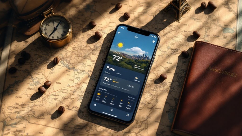
Three critical factors make AccuWeather the gold standard for travel forecasting: unmatched accuracy, real-time precision, and global coverage.
You'll get street-level forecasts for over 3 million locations worldwide, with MinuteCast® providing minute-by-minute precipitation updates for your exact location.
Whether you're traveling through Scandinavian fjords or tracking monsoons in Asia, AccuWeather's got your back with forecasts in 75+ languages.
Plus, their "Follow Me" mode keeps you updated with alerts based on your movement, so you're always prepared for whatever Mother Nature throws your way.
Looking to breeze through U.S. customs without the hefty price tag of Global Entry? Mobile Passport Control (MPC) might be your new best friend.
Skip the Global Entry fees – Mobile Passport Control offers a smart, budget-friendly way to speed through U.S. customs.
This free app, available for both iOS and Android, lets you skip those dreaded paper forms and kiosk lines at over 50 locations across the U.S.
You'll simply create a profile, store your passport details locally on your device, and submit your travel info upon arrival. The app generates a QR code that gets you access to designated MPC lanes, which are often shorter than regular lines.
While you'll still need your physical passport for the final inspection, you can complete the process while your plane's still taxiing to the gate.
Plus, you can add up to 12 family members to your submission, making group travel a breeze.
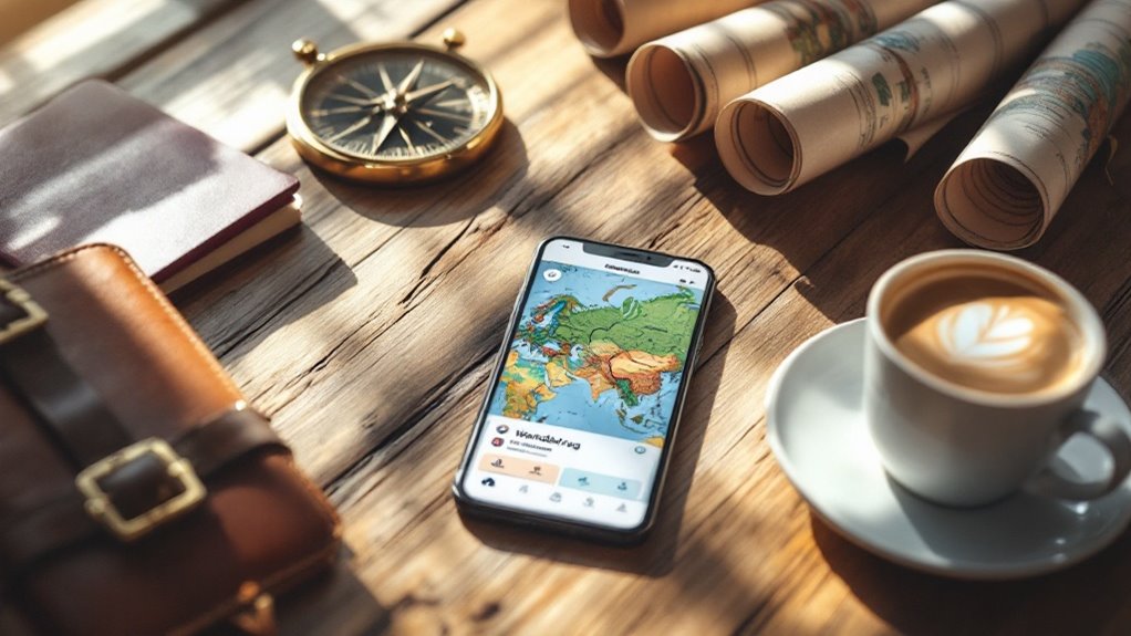
Planning a group trip no longer means juggling endless email threads and confusing spreadsheets, thanks to Wanderlog's powerful collaborative features.
You'll love how the app lets everyone contribute to the itinerary in real-time, with clear attribution showing who added what.
Here's what makes Wanderlog a game-changer for your next adventure:
The app's seamless integration with Google Maps and smooth syncing between web and mobile makes planning your next getaway feel less like work and more like fun.
Travel frustrations melt away with Rome2Rio, your ultimate companion for traversing complex journeys across the globe.
You'll discover door-to-door routes combining flights, trains, buses, and ferries across 240+ countries, while comparing costs and travel times for each option. Whether you're planning a quick weekend getaway or an international adventure, you can explore multiple transportation combinations to find your perfect route.
The app's strength lies in its partnerships with over 4,800 transport operators, ensuring you'll get extensive coverage wherever you're headed.
You can save your favorite routes, share them with travel buddies, and access the service in six languages. With both web and mobile platforms offering free unlimited searches, plus handy currency conversion features, Rome2Rio takes the guesswork out of journey planning.
While mastering transportation routes gets you from A to B, keeping track of your travel companions adds another layer of security to your journey. Life360's real-time location tracking transforms your phone into a powerful safety hub, keeping your travel circle connected whether you're walking through Paris or flying to Tokyo.
You'll appreciate these standout features that bring peace of mind to your adventures:
With premium perks like international medical coverage and identity theft protection, Life360 serves as your digital guardian, ensuring you're never truly traveling alone.
Culture Trip's real-time location features help you uncover hidden treasures that even locals might miss, from tucked-away art galleries to authentic neighborhood eateries.
You'll find the app's cultural events calendar especially useful, as it keeps you informed about upcoming festivals, exhibitions, and local celebrations that match your interests.
Whether you're wandering through Paris's back alleys or exploring Tokyo's lesser-known districts, Culture Trip transforms your spontaneous walks into meaningful cultural discoveries.
Discovering hidden gems in a new city becomes remarkably easier with community-driven platforms that connect you directly with locals. Apps like Showaround and Withlocals help you uncover those secret spots that guidebooks often miss, while real-time recommendations keep you in the know about what's happening nearby.
You'll love how these apps use your location and preferences to suggest off-the-beaten-path attractions.
Whether you're a foodie looking for authentic local cuisine or an adventure seeker wanting unique experiences, there's a platform that'll match your interests.
Plus, with direct messaging features, you can easily connect with local guides to plan your perfect hidden gem adventure.
Three powerful event discovery platforms – Eventful, Tripit, and Culture Trip – transform your travel experience by putting local festivals, concerts, and exhibitions at your fingertips.
You'll stay up-to-date with real-time schedule changes and venue updates, while smart filters help you find exactly what interests you, from art shows to food festivals.
Want to dive deeper into local culture? These apps connect you with authentic experiences like cooking classes and guided walks led by resident experts.
You can even join intimate dinner parties hosted by locals or discover off-the-beaten-path workshops. The best part? Everything syncs seamlessly with your calendar, and you'll get instant notifications about ticket availability or last-minute changes.
Plus, with offline access to maps and event details, you're covered even without internet connection.

When it comes to documenting your travel adventures, Polarsteps differentiates itself as a game-changing app that's revolutionizing how we capture and share our journeys.
With automatic GPS tracking and offline functionality, you'll never miss recording a moment of your travels, while the app's intuitive interface lets you enhance your route with photos, videos, and personal notes.
Never lose a travel moment with seamless GPS tracking and an intuitive interface for adding photos, videos, and notes.
Whether you're backpacking through Europe or road-tripping across continents, Polarsteps transforms your travels into stunning visual stories that you'll treasure for years to come.
While Polarsteps helps you document your adventures, staying safe during your travels requires a different kind of digital companion.
Sitata's AI-powered system watches over your journey 24/7, scanning global news and social media to alert you about potential disruptions that could affect your trip. You'll receive instant notifications about everything from flight delays to local protests, while the app's interactive risk map helps you visualize potential threats worldwide.
What makes Sitata particularly valuable is its extensive support system. You can connect with travel medicine specialists via video chat, access local healthcare facilities, and even process insurance claims through the mobile app.
Whether you're dealing with a medical emergency or need to navigate COVID-19 requirements, Sitata's multilingual platform keeps you informed and protected across 195+ countries.
You'll never need to be that clueless tourist holding a paper map upside down again – these apps have got your back! While they won't prevent you from making questionable souvenir choices or ordering mystery meat from street vendors, they'll at least help you navigate, communicate, and stay safe while doing so. Transform your smartphone into a savvy travel companion, and you're ready to explore the world with confidence, if not always with grace.